This is why recent attempts to downplay the dilution of Aravalli protection, by invoking narrow definitions of what constitutes a “hill,” are deeply troubling. In November this year, the Supreme Court agreed to the Central government’s new definition of an “Aravalli Hill” as any landform in designated Aravalli districts that has an elevation of 100 m or more above local relief (including its slopes and enclosed contours). Furthermore, it stated that a “Aravalli Range” is where two or more such hills lie within 500 m of each other, and the entire area within those contours (including the land between hills) is treated as part of the range.
Recently, the Union Environmental Minister Bhupender Yadav defended this definition and claimed that there is no threat, saying 90% is still protected. He added that only 2 per cent can be mined, and that the Supreme Court has imposed a ban on any new mining licence until a detailed study is undertaken.
The crux of the problem here is exactly what is happening in the Himalayas, or for that matter, in forests in Chhattisgarh. The entire approach of the Modi government on issues of crucial ecological areas has not been from the environmental perspective, but from the outlook of mining, real-estate, and large corporates. It is important to mention that the Aravalli range is rich in minerals such as limestone, marble, quartz, copper, zinc, and other building stones, especially in Rajasthan and parts of Haryana.
Further, the narrow, short-term, and corporate-driven approach totally negates the impact of the climate crisis and the geological formations. We have seen the same outlook in the Himalayas, where rampant destruction and unplanned constructions and industries have led to disasters and increasing threats of glacier meltdowns. In Chhattisgarh, ecologically sensitive areas are being sold off to Adani and other corporates without any consideration for local ecology.
The recently adopted definition of the Aravalli Range, which relies primarily on height-based geomorphological thresholds, departs significantly from international standards used to identify, classify, and protect environmentally sensitive mountain and hill systems. Global institutions such as the International Union for Conservation of Nature (IUCN) and the Convention on Biological Diversity define and protect landscapes based on what they do, not merely on how tall they appear. Old mountain ranges across the world, like the Appalachians in North America or the Scottish Highlands in Europe, retain protection because of their geological continuity, hydrological function, ecological connectivity, and role in climate regulation, even where their present-day elevation is modest. To ignore these principles is to reject decades of scientific consensus.
The Aravalli system that spans approximately 670 km (420 mi) in a south-west direction, starting near Delhi, passing through southern Haryana and Rajasthan, and ending in Ahmedabad, is not made up of tall hills everywhere and is not uniform across states. At several places it has low ridges, broken hillocks, and shallow rises crucial for ecology. Many of these do not cross the 100 m threshold, especially in Haryana and Rajasthan.
The further issue is that the definition was created for the convenience of industry, before any comprehensive, landscape-scale ecological mapping of the Aravalli system, except in protected and wildlife zones. The 100 m hill and 500 m range definition completely ignores the ecological and hydrological importance of smaller ridges and other geological features.
The argument that a buffer between hills compensates for this restrictive definition is equally misleading. In practice, mining has fragmented continuous ridges into isolated remnants, many of which no longer qualify for protection once reduced below an arbitrary threshold due to constant weathering or human-made activities.
Moreover, using a 100-metre benchmark and measuring elevation from local relief or profile (the immediate surroundings of a hill) rather than from a standardised baseline such as the state’s lowest elevation would mean that a substantial portion of the Aravalli range would no longer be classified as part of the Aravallis
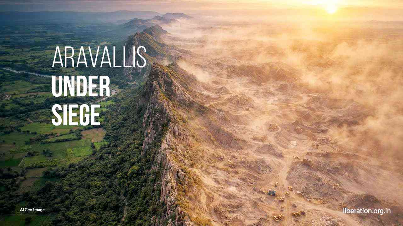
The degradation of Aravalli in Rajasthan, from where the new definition is borrowed, is the prime example of how a narrow definition has led to rampant mining and destruction. As per a study by CU Rajasthan, this has led to an increase in sandstorms, and at least 31 hills in the upper Aravalli range (Haryana-northern Rajasthan) have disappeared in the last two decades, besides several other hills in the lower and middle ranges. In Haryana, similar stories are everywhere, with Aravallis degrading rapidly due to mining, stone quarrying, and other activities. These studies show that once a ridge is breached, erosion accelerates, vegetation fails to regenerate, and surrounding areas become vulnerable to further extraction. The consequence of this piecemeal destruction is visible in rising temperatures, intensifying dust storms, declining groundwater, and the slow but steady march of desert-like conditions eastward.
In a region already facing acute water stress, the fractured quartzites, natural cracks and fissures, and weathered slopes of the Aravallis act as natural reservoirs, capturing monsoon rainfall and feeding aquifers that sustain agriculture and urban populations alike. Beyond visible hills, the Aravallis give rise to a dense network of seasonal drainage systems—nalas, ravines, gullies, and ephemeral streams that carry monsoon runoff from rocky ridges into the plains of Haryana, Delhi, and eastern Rajasthan. International water-security frameworks treat such recharge landscapes as critical natural infrastructure, deserving of the highest level of protection.
The new definition, however, renders many of these areas invisible, opening them to mining, construction, and irreversible damage. The future opening up of “regulated mining” under the new definition will also adversely affect the forest-dwelling and forest-dependent communities, as well as pastoral communities. By excluding low hills, scrub forests, rocky plains, and pediments from the legally recognised Aravalli system, it removes protection from precisely the landscapes most used by forest-dwelling and pastoral communities, with mining companies taking over these areas and destroying livelihoods.
For Delhi and its surrounding region, which are at the receiving end of extreme heat, dust, and pollution, the Aravallis function as a critical climate buffer. Their forest cover, rocky terrain, and open scrublands moderate land-surface temperatures, reduce dust loading, and influence local wind patterns.
The Aravallis cannot be preserved through technical definitions or conditional buffers. In fact, the Forest Survey of India, particularly in its submissions to court-mandated committees and in internal mapping exercises over the past decade, treated the Aravalli Range as a geo-ecological landscape, not just a collection of tall hills. Their submission (as reported by various news reports) revealed that only 8.7% of the Aravalli Hills, comprising 1,048 out of 12,081 hills, meet the 100-meter height criterion. It noted that the 20 m height cut-off is crucial for a hill’s function as a wind barrier. FSI has been using a 3-degree slope yardstick to define Aravalli Hills since 2010, and a technical committee formed in 2024 modified the benchmark and proposed to identify as Aravalli Hills any landform with a slope of at least 4.57 degrees and a height of at least 30 m. The Indian Express reported that despite concerns from experts that “the 100-m cut-off would protect only a few guard posts while surrendering the fences below,” the central government prescribed the 100-m definition to the SC.
In fact, the pseudo-scientific approach to questions of ecology and climate is not new for this government. In Uttarakhand, the Modi government divided the massive 900 km Char-Dham road into 53 smaller segments, each under 100 km, to bypass the mandatory, comprehensive Environmental Impact Assessment (EIA) required for large projects. Similarly, in the Great Nicobar Swap – compensatory afforestation, the government destroyed 130 sq km of pristine tropical forest in Great Nicobar Island for a mega development project and built “compensation” in the Aravallis of Haryana, a place 2,400 km away and in a totally different ecosystem and climatic conditions. And now the Modi government sells this as the Aravalli Green Wall Project.
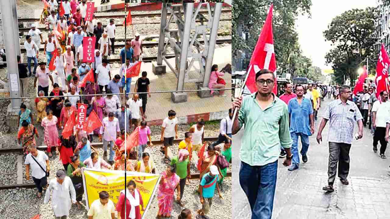
The Modi regime’s ploy for the destruction of Aravallis, under the guise of ‘sustainable mining,’ is being exposed as people rise in protests. The ‘Save Aravalli’ campaign is intensifying, and with protests from Gurugram to Udaipur, people see through the lies of the government.
A government whose entire premise of governance is exploitation of people and environment for corporate profit treats the Aravallis, like the Himalayas or vast forests across the country, as part of the “Ease of Doing Business” strategy. But for us and generations to come, as was for our previous generations, the protection of jal-jungle-zameen (water, forests, land, and hills) is vital and must not be sacrificed on the altar of profits for the rich.